Format: Paperback
Pages: 192
ISBN: 9781905119448
Pub Date: 07 Feb 2013
Description:
South Cambridgeshire has some of the richest arable land in England and has been cultivated for millennia. By the turn of the nineteenth century industrialisation and massive population growth had resulted in an enormous increase in the demand for food, which in turn led to enclosure. But this desire to plough every available piece of land resulted in the destruction of many valuable and distinctive habitats that had existed for centuries.
The Ecology of Enclosure breaks new ground in comparing the effect of Parliamentary Enclosure with the findings of the enthusiastic 'Botanisers' from Cambridge; this reveals not only the effect of enclosure on the ecology of the land but also on the people whose link with the land was broken. The first section presents a study of social and agricultural life before enclosure, describing geology and climate; the fold-course open field system of farming and the strict stinting rules which governed how land could be used for grazing and stock movement; and the crop rotation systems employed. The second part describes the process of enclosure, including opposition to it; the changes that occurred to the landscape and within village communities as work in industry gradually replaced rural occupations; the effects of fencing on movement; and of the loss of common land to the plough. The third section is an analysis of the new study of Botany which the University of Cambridge was enjoying in the eighteenth and nineteenth centuries based on their own records and a review of some of the specific effects on the flora and fauna of the area.
Format: Paperback
Pages: 416
ISBN: 9781905119455
Pub Date: 07 Feb 2013
Illustrations: 233 illus
Description:
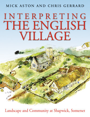
An original and approachable account of how archaeology can tell the story of the English village. Shapwick lies in the middle of Somerset, next to the important monastic centre of Glastonbury: the abbey owned the manor for 800 years from the 8th to the 16th century and its abbots and officials had a great influence on the lives of the peasants who lived there. It is possible that abbot Dunstan, one of the great reformers of tenth century monasticism directed the planning of the village.
The Shapwick Project examined the development and history of an English parish and village over a ten thousand-year period. This was a truly multi-disciplinary project. Not only were a battery of archaeological and historical techniques explored - such as field walking, test-pitting, archaeological excavation, aerial reconnaissance, documentary research and cartographic analysis - but numerous other techniques such as building analysis, dendrochronological dating and soil analysis were undertaken on a large scale. The result is a fascinating study about how the community lived and prospered in Shapwick. In addition we learn how a group of enthusiastic and dedicated scholars unravelled this story. As such there is much here to inspire and enthuse others who might want to embark on a landscape study of a parish or village area. Seven of the ten chapters begin with a fictional vignette to bring the story of the village to life. Text-boxes elucidate re-occurring themes and techniques. Extensively illustrated in colour including 100 full page images.This title was the winner of the 2014 British Archaeological Association's Best Archaeological Book Award.
Format: Hardback
Pages: 300
ISBN: 9781901992045
Pub Date: 29 Jan 2013
Series: MoLAS Monograph
Description:
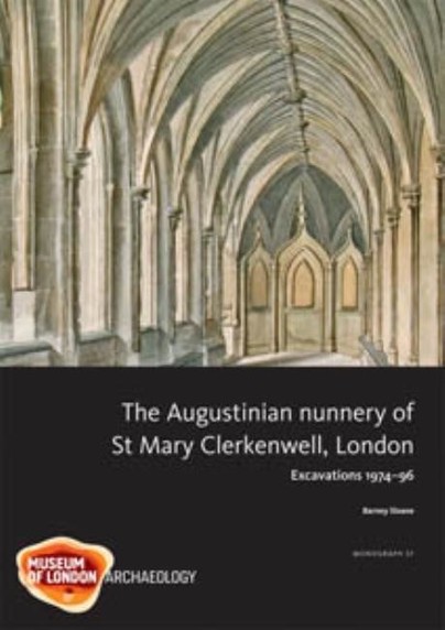
The development of the nunnery site is revealed in this study - from evidence for Iron Age occupation, the nunnery's foundation in 1144 and the expansion of the early convent, through to its conversion in the 16th and 17th centuries to a close of large mansions surrounding the parish church. Drawing together the varied evidence, including illustrations made during the demolition of the nunnery church in 1788-9 and 18th-century surveys, has allowed detailed reconstructions of the church and cloister. Relatively wealthy, located in Londons medieval suburbs and with a dual role as convent and parish church, St Marys story contrasts with that of many other, poorer and more rural, nunneries.
Format: Paperback
Pages: 190
ISBN: 9789088900921
Pub Date: 31 Dec 2012
Description:
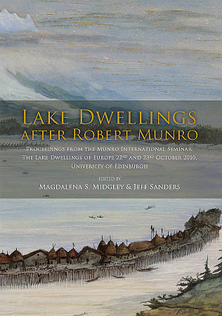
Dr Robert Munro (1835-1920) was a distinguished medical practitioner who, in his later life, became a keen archaeologist. His particular interests lay in the lake-dwelling settlements of his native Scotland, known as crannogs, as well as those then being discovered across Europe. In 1885 Robert Munro undertook a review of all lacustrian research in Europe, travelling widely to study collections and visit sites.
The results of this work formed the basis for the prestigious Rhind Lectures at the Society of Antiquaries of Scotland in 1888. These were then published as The Lake-Dwellings of Europe, a landmark publication for archaeology and one that cemented Munro’s archaeological reputation.In 1910 Robert Munro offered the University of Edinburgh a financial gift with which to fund lectures in Anthropology and Prehistoric Archaeology. Over the past century this has been done through the Munro Trust. In 2010, the year of the centenary of the Munro Trust, the University of Edinburgh and the Society of Antiquaries of Scotland jointly celebrated the occasion with a gathering of Continental and British scholars. The papers presented in this publication are the results of that international seminar.This book will engage all those interested in European lake dwellings, wetland archaeology and the history of archaeology in the 19th century. The collected papers explore the historical context of Munro’s work, as well as introducing current research from across Europe. The book will appeal to both the professional and the interested amateur, of which Munro himself represented such an exciting synthesis.
Format: Paperback
Pages: 100
ISBN: 9781907588044
Pub Date: 01 Dec 2012
Series: East Anglian Archaeology Monograph
Description:
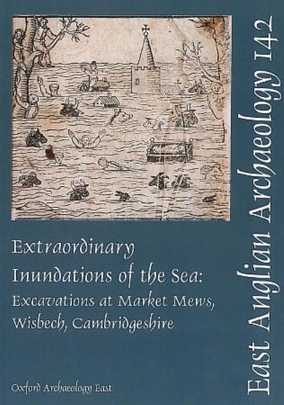
This publication describes a relatively small excavation (by CAM ARC, now Oxford Archaeology East), whose size belies its significance. Incredibly, this is the first properly documented archaeological excavation in the core of Wisbech - an historic town long suspected to have preserved interesting medieval deposits. It fills a gaping void in previous knowledge of the character and quality of the archaeological remains in the town and represents an important first step in redressing the regional imbalance in published medieval port sequences, such as those of King's Lynn and Great Yarmouth.
The site lies within the confines of the New Market, to the north of the Norman castle. An impressive sequence of deeply stratified medieval to early post-medieval deposits was revealed, demonstrating at least thirteen building phases, the earliest of which dates to the 13th century. One structure contained evidence for in-situ metalworking during the mid 14th to mid 15th century. The buildings were each sealed by fine silts deposited during episodic flooding which can be broadly linked to documented climatic conditions of the period. Detailed recording was achieved through micromorphological analysis and the use of high resolution thin sections. While the alternate sequence of occupation and flooding found at Wisbech is broadly comparable to deposits in other regional port towns, it is almost without parallel in terms of its completeness, depth and state of preservation. A wealth of organic remains and subtle features are present, which rarely survive elsewhere in East Anglia. The discovery of this important archaeological resource highlights the requirement for consideration of its future management.
Format: Hardback
Pages: 620
ISBN: 9780904220681
Pub Date: 15 Oct 2012
Series: Oxford Archaeology Monograph
Description:
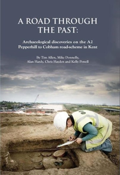
Excavations along the new road line have revealed nearly 6000 years of human activity, from a massive marker post erected by early Neolithic farmers at the head of a dry valley to a bizarre burial of several different animals dating to the sixteenth century AD. Prehistoric discoveries include two enclosures of the middle Bronze Age, both associated with some of the earliest cobbled roads in Kent, a collection of Iron Age storage pits rich in diverse deliberate offerings, and the emergence of a nucleated hamlet in the middle Iron Age. Most exciting were rich cremation burials of the late Iron Age and early Roman periods, probably successive generations of a local family, whose rise to prominence coincides with the growth of the cult centre at Springhead nearby.
The metal vessels include types new to Britain, the pottery stamps suggest the movement of continental potters to Kent, and one grave has the clearest evidence of furniture yet found from early Roman Britain. Medieval settlements of the late 11th-14th centuries mirror the renewed importance of Watling Street after the Norman conquest, and its eventual return to obscurity due to competition from the ferry from London to Gravesend.
Format: Hardback
Pages: 280
ISBN: 9781842174692
Pub Date: 30 Jun 2012
Illustrations: 111 col & b/w illus
Description:
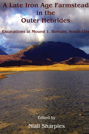
The settlement at Bornais consists of a complex of mounds which protrude from the relatively flat machair plain in the township of Bornais on the island of South Uist. This sandy plain has proved an attractive settlement from the Beaker period onwards; it appears to have been intensively occupied from the Late Bronze Age to the end of the Norse period. Mound 1 was the original location for settlement in this part of the machair plain; pre-Viking activity of some complexity is present and it is likely that the settlement activity started in the Middle Iron Age, if not earlier.
The examination of the mound 1 deposits provides an important contribution to our understanding of the Iron Age sequence in the Atlantic province. The principal contribution comprises the large quantities of mammal, fish and bird bones, carbonised plant remains and pottery, which can be accurately dated to a fairly precise and narrow period in the 1st millennium AD. These are augmented by a substantial collection of small finds which included distinctive bone artefacts. The contextual significance of the site is based on the survival of floor deposits and a burnt-down roof; the floor deposits can be compared with abandonment and adjacent midden deposits providing contrasting contextual environments that help to clarify depositional processes. The burning down of the house and the excellent preservation of the deposits within it provide an unparalleled opportunity to examine the timber superstructure of the building and the layout of the material used by the inhabitants.
Format: Hardback
Pages: 368
ISBN: 9781842174470
Pub Date: 30 Apr 2012
Illustrations: 130 b/w & 78 col illus
Description:
Eventful, influential and absorbing, the early history of Northumberland is a fascinating story that has rarely been brought together under one cover. In this authoritative historical account, the authors bring to bear a huge quantity of old and new data and craft it into an in-depth synthesis. The authors deliver this history in chronological order from a perspective that places human activity and environment at its core.
The narrative extends from the Palaeolithic through to, and including, the Anglo-Saxon period. This enormous sweep of history is supported by a robust radiocarbon chronology, with all available dates for the region brought together and calibrated against the most recent calibration curves for the first time. The geographic focus of the volume is North Northumberland but the narrative frequently extends to cover the whole county and occasionally further afield into neighbouring areas so as to deal with key topics at an appropriate geographic scale and to take account of important information from nearby areas. This second volume in the Till-Tweed monograph series follows on from the first volume, Managing Archaeological Landscapes in Northumberland , which provided a considerable quantity of new field data, in addition to presenting a landscape management methodology based around the "landform element" approach.
Format: Paperback
Pages: 204
ISBN: 9781902771892
Pub Date: 31 Dec 2011
Description:
Britain's abolition of the slave trade in 1807 did not end the traffic of human beings across the Atlantic. Indeed, for many decades to come, hundreds of thousands of enslaved Africans continued to be shipped into slavery. From 1840 to 1872 the remote South Atlantic island of St Helena played a pivotal role in Britain's efforts to suppress the slave trade, and over this time it received over 25,000 'liberated Africans', taken from slave ships by Royal Navy patrols.
Conditions aboard the slavers were appalling, and many did not survive the journey. Rupert's Valley therefore became a graveyard to many thousands of Africans - 'a valley of dry bones' in the words of a visiting missionary. In 2008 archaeological excavations uncovered a small part of that graveyard, revealing the burials of over 300 victims of the slave trade. It was disposal on a massive scale, with the dead interred in a combination of single, multiple and mass graves. This book presents the finding of the archaeological and osteological study, and in so doing brings the inhumanity of the slave trade into vivid focus. It tells the story of a group of children and young adults who had lived in Africa only a few weeks prior to their death on St Helena, and whose remains bear witness to the cruelty of their transportation. However, the archaeology also shows them as more than just victims, but also as individuals with a sense of their own identity and culture. The slave trade continues to this day, and although this book is a study of the past it also serves as a reminder of evils that persist into the modern day.
Format: Paperback
Pages: 192
ISBN: 9780714123318
Pub Date: 30 Nov 2011
Description:
This is last in a series of fascicules publishing the British Museum's programme of research excavations at Grimes Graves, Norfolk. Research into flint mines such as Grimes Graves, one of the largest Neolithic flint mine complexes in Europe, offers a fascinating glimpse into the practical knowledge and skills of humans at that time. This fascicule considers the miners' methods as well as their motivation and the uses to which the finished products were put.
Ian Longworth was formerly Keeper of Prehistoric and Romano-British Antiquities at the British Museum, Gillian Varndell is a curator of Prehistory and Europe at the British Museum and Jacek Lech has a professorship at the Polish Academy of Sciences, Warsaw.
Format: Paperback
Pages: 170
ISBN: 9780956305442
Pub Date: 30 Nov 2011
Imprint: Pre-Construct Archaeology
Illustrations: 73 figures in b/w and colour
Description:
This publication presents the results of archaeological investigations by Pre-Construct Archaeology at Laurel Farm to the south-east of Norfolk. An extraordinarily long and complex history of occupation and exploitation was revealed, dating back to the Lower Palaeolithic. The site was also visited in the Upper Palaeolithic by hunter-gatherer communities who used the shelter provided by the roots of an upturned tree to knap flint into blades and tools.
Tree-throw hollows continued to be significant features in the landscape and, in the Early Neolithic, a remarkable deposit of pottery and flint was placed into a pair of adjacent hollows . Around 4,500 years ago, use of the area changed with the construction of a substantial ring-ditch, probably the remains of a ploughed-out round barrow. From the late Anglo-Saxon into the early Medieval period the area was used for the early stages of iron extraction and production - processes which have rarely been identified archaeologically. There is evidence that ore was quarried, washed and roasted to remove impurities. Mousehold Heath continued to be visited for its natural resources, with gravel quarries and brick kilns exploiting the natural clays, until pressures on agricultural production towards the end of the eighteenth century resulted in the enclosure of the landscape.
Format: Paperback
Pages: 184
ISBN: 9781905119394
Pub Date: 14 Oct 2011
Illustrations: 73 col & b/w illus
Description:
Ancient Trees in the Landscape is the outcome of many years research into the history of trees in Norfolk, and represents the first detailed, published account of the ancient and traditionally managed trees of any English county. Yet it is far more than a regional survey. It is an exploration of how trees can be studied as part of the landscape.
It discusses how accurately trees can be dated; explains why old trees are found in certain contexts and not in others; discusses traditional management practices and how these changed over time; and looks at the various ways in which trees have been used in parks and gardens. Above all, it considers how trees were regarded by people in the past, and how this has affected their survival to the present. Ancient Trees in the Landscape is a fascinating and original study which sets out a new agenda in landscape history. It will be essential reading for countryside managers and conservationists, and for all those interested in landscape history, arboriculture, and the history of the English countryside.
Format: Paperback
Pages: 116
ISBN: 9780951069561
Pub Date: 01 Oct 2011
Series: East Anglian Archaeology Occasional Paper
Description:
This review of Research and Archaeology augments the regional research framework, which appeared in two parts as a Resource Assessment (Glazebrook ed. 1997); and a Research Agenda and Strategy (Brown and Glazebrook eds 2000). The review considers new evidence on a period-by-period basis, with each period subdivided into an assessment of key projects undertaken since 2000, an assessment of progress on research topics proposed in 2000 and a consideration of future research topics.
The regional research framework was never intended to be a fixed point but rather a dynamic process through which the region's archaeology can be influenced, and subject to periodic review and revision. All three parts of the framework are available online (at www.eaareports.org.uk) and will be kept live and updated by the historic environment community of the East of England as new discoveries are made and new research priorities established.
Format: Paperback
Pages: 76
ISBN: 9781907586033
Pub Date: 21 Sep 2011
Series: MoLAS Archaeology Studies Series
Description:
Excavations in 2006-8 by MOLA on the site of St Giles Court, on the north side of St Giles High Street, Camden, illustrate the development of this London suburb from the medieval period to the early 20th century. Located opposite the parish church of the former medieval leper hospital of St Giles-in-the-Fields, the site was open ground and gardens until the mid-16th century when residential houses were built along the High Street. St Giles was at the heart of London suburban expansion by the mid-17th century.
At this time it was a relatively prosperous district, with houses lining the main streets and businesses developing behind, including the Eagle and Child and Hampshire Hog inns. The numerous objects recovered indicate a varied standard of living among the inhabitants. By the late 18th century the reputation of the St Giles area and its housing had declined and the site lay within the southern core of the area known as the "Rookery" - a notorious late 18th- and 19th-century slum. However, this study reveals that the area's image may not be entirely matched by reality: it found evidence of contrasting lifestyles, households and businesses in this period, including a prosperous family brewery, before the area eventually lost its residential character and became almost purely commercial.
Format: Hardback
Pages: 592
ISBN: 9781907586040
Pub Date: 15 Aug 2011
Series: MoLAS Monograph
Description:
The site of 1 Poultry, excavated in the 1990s, is located near the Bank of England in the heart of the City of London. It lay immediately west of the point where the main east-west road through Roman London bridged the Walbrook stream and proved to be one of the most significant archaeological sites ever excavated in the City, with an unparalleled sequence of buildings, roads and open spaces. A timber drain of AD 47 beneath the main road is the earliest, securely dated structure yet known from Londinium and a pottery shop destroyed in the Boudican revolt gives a snapshot of life in AD 60/61.
A 2nd-century AD writing tablet preserves the only evidence for the sale of a slave found in Britain to date, while the 3rd- and 4th-century buildings on the site provide a rare demonstration of the continuities and changes that occurred in Roman urban life. The key sequence from 1 Poultry provides the majority of the evidence but is augmented by findings from Docklands Light Railway sites at Bucklersbury, Lothbury and Lombard Street and other work at 72-75 Cheapside, 76-80 Cheapside, 36-37 King Street and Mansion House. Together, the sites provide a comprehensive record of the development of Londinium over the entire Roman period.